§ Route Maps
Every sailing, drawn as a route.
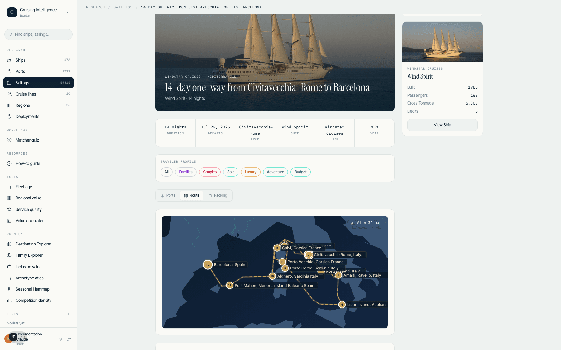
SVG route visualization for every itinerary - port sequence, distances, and sea days. Handles rivers and the antimeridian without breaking the chart. Mini-maps on every itinerary card, plus a detailed route view.
Start 14-day trial68,722 itineraries · 12,258 corridors charted
cruisingintelligence.com / app / itineraries
How routes are drawn.
Every itinerary renders as a clean SVG chart: the full port sequence with numbered stops, leg distances between consecutive ports, and open-water segments marked as sea days. No panning across an interactive map - the whole voyage fits on one chart you can read at a glance.
The hard cases are handled, not ignored. River itineraries follow the inland waterway instead of drawing a straight line through land. Transoceanic crossings split cleanly at the antimeridian, so a transpacific sailing doesn't wrap around the chart and stab through a continent.
Two levels of detail cover the whole workflow: a mini-map on every itinerary card for scanning a shortlist, and a detailed route view for walking a client through the voyage stop by stop.
What each chart shows.
Port sequence
Numbered stops in sailing order, with embarkation and disembarkation marked.
Distances
Leg-by-leg distances between consecutive ports, so "how far is it to the next stop?" has an answer.
Sea days
Open-water segments called out explicitly - clients know exactly what to expect.
Mini-maps
A compact route chart on every itinerary card. Scan a shortlist without opening each sailing.
Detailed view
The full route, enlarged - built for the consultation desk, not just the browse page.
Rivers & antimeridian
Inland waterways follow the river. Transoceanic crossings split cleanly at the antimeridian.